| |
tiranaworkshop_site
This version was saved 13 years, 6 months ago
View current version Page history
Saved by l_triantis@yahoo.com
on October 1, 2010 at 1:59:51 pm
|
TiranaWorkshop II
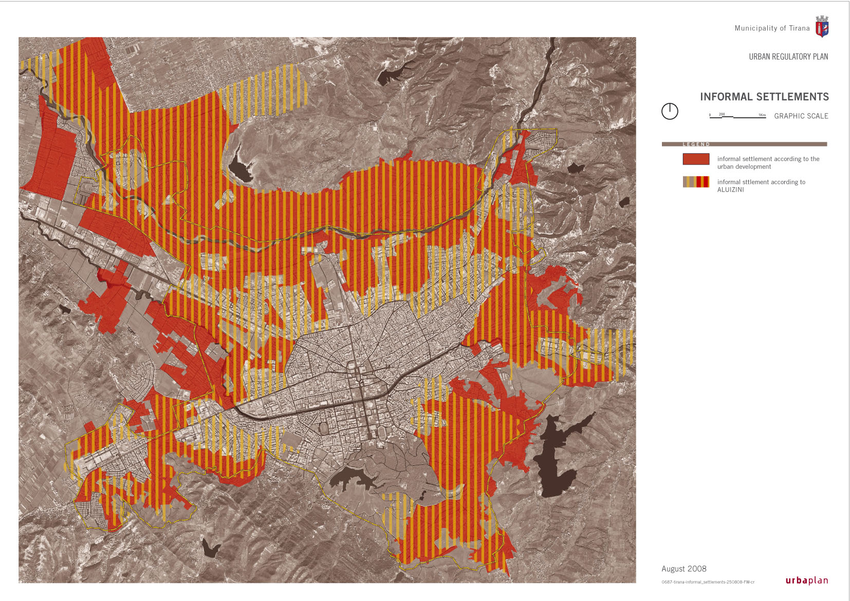
The Study Area is located in western Tirana and is surrounded by Lana River (south), the second ring road (east), an informal housing zone (north) and a former industrial zone of an evolving character (west). It is crossed by Kavaja Str., one of the main axes of the Albanian capital with commercial and mixed uses.
|
View Larger Map
| Maps and Aerial photos: |
Tirana Map [dwg] |
| |
Tirana Aerial Photo |
| |
Study Area Close up |
| |
|
| Thematic maps: |
Existing Land Uses Map |
| (material from Tirana Regulatory Plan, by URBAPLAN and Tirana Municipality) |
Urban Expansion Map |
| |
Informal Areas Map
|
| |
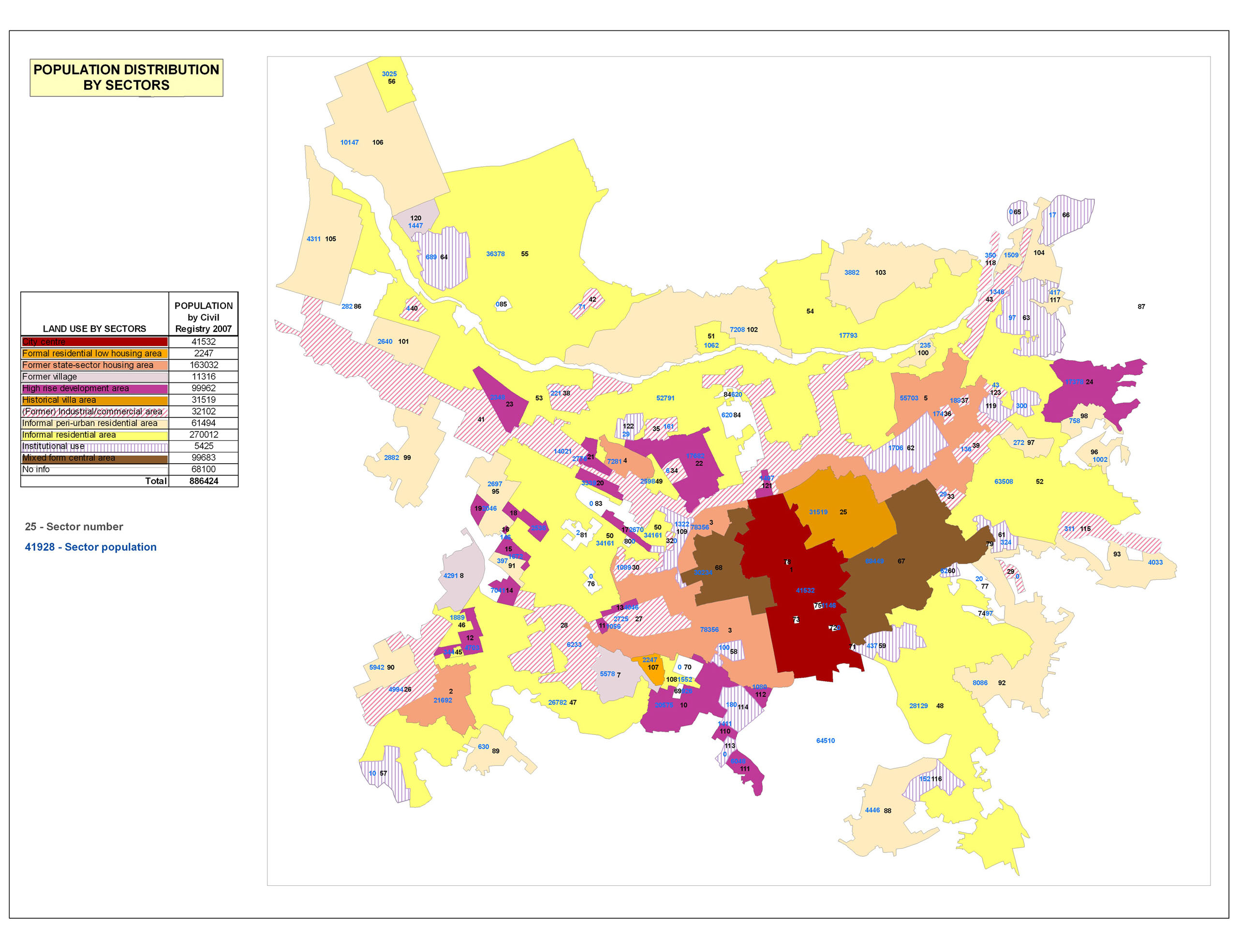
Population Distribution Map
|
| |
Population Densities Map |
| |
Socio-Economic Structure Map |
| |
|
| |
Urban Typologies Map
|
| |
Urban Structure Map
|
| |
New Economic Activities Map
|
| |
Regulatory Plan Map
|
| |
Regulatory Plan (extracts on former-state housing)
|
tiranaworkshop_site
|
|
Tip: To turn text into a link, highlight the text, then click on a page or file from the list above.
|
|
|
Comments (0)
You don't have permission to comment on this page.