|
TiranaWorkshop II
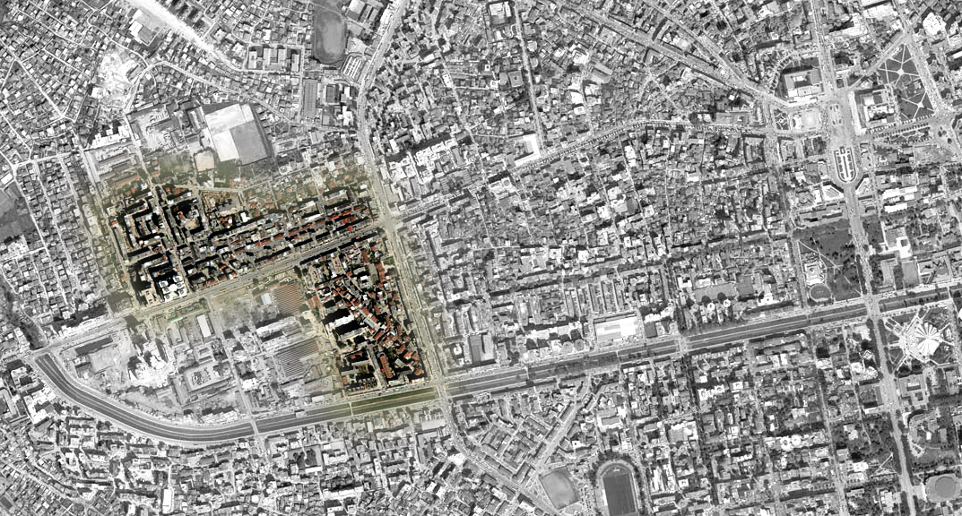
The Study Area is located in western Tirana and is surrounded by Lana River (south), the second ring road (east), an informal housing zone (north) and a former industrial zone of an evolving character (west). It is crossed by Kavaja Str., one of the main axes of the Albanian capital with commercial and mixed uses. |
| Maps and Aerial photos: | Tirana Map [dwg] [pdf] |
| Tirana Aerial Photo | |
| Study Area Close up | |
| Map of Tirana city (1957) | |
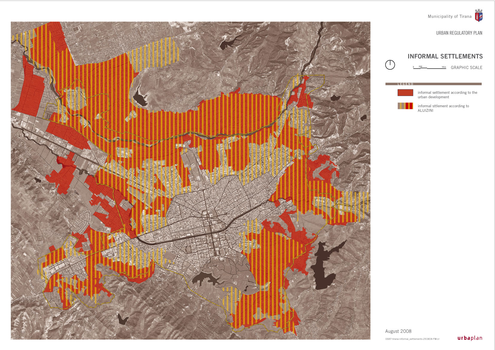
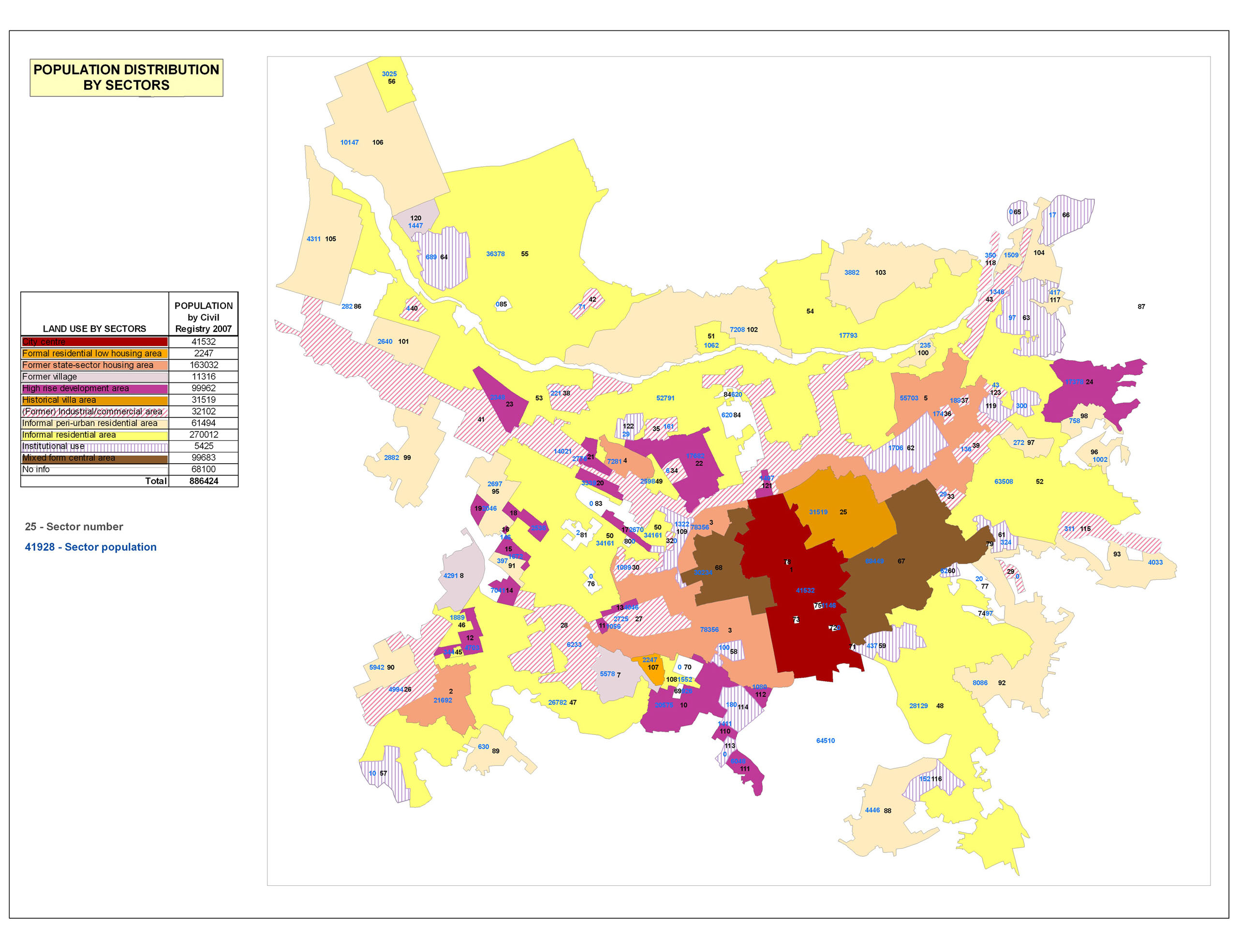
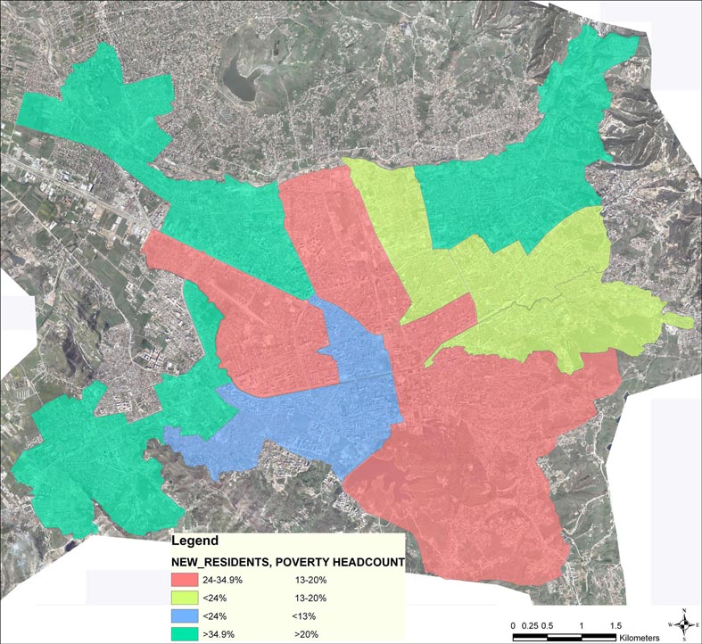
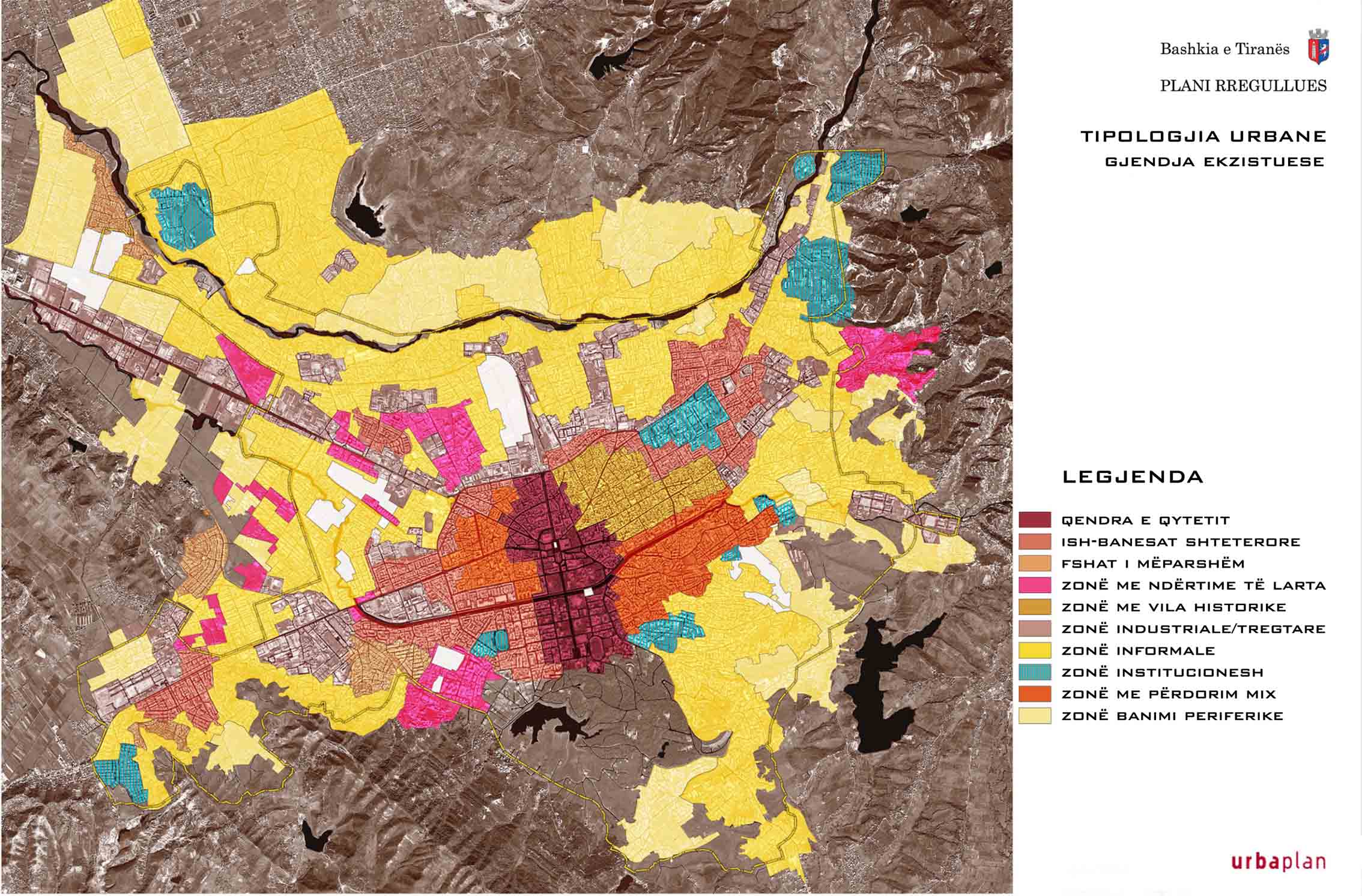
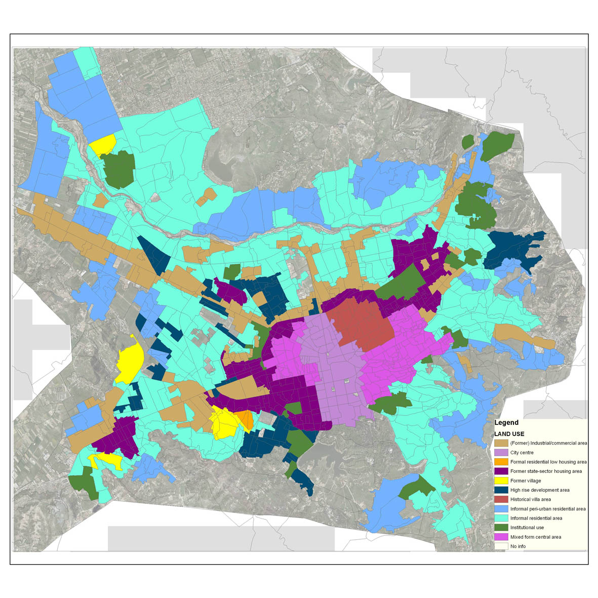
| Thematic maps: | Existing Land Uses Map |
| (material from Tirana Regulatory Plan, by URBAPLAN and Tirana Municipality) | Urban Expansion Map |
| Socio-Economic Structure Map | |